Thirty-six hours of lightning in the severe storms over the Eastern US a week ago, captured by the new GOES-16 NOAA satellite, which launched last November. It was known as GOES-R before launch.
Summarizing the satellite’s capabilities:
GOES-R will scan the skies five times faster than today’s GOES spacecraft, with four times greater image resolution and three times the spectral channels. It will provide high-resolution, rapid-refresh satellite imagery as often as every 30 seconds, allowing for a more detailed look at a storm to determine whether it is growing or decaying.
This image demonstrates the vast increase in resolution from GOES-13 (r) to GOES-16 (l). It’s 4572 x 2252 and 7.3MB:
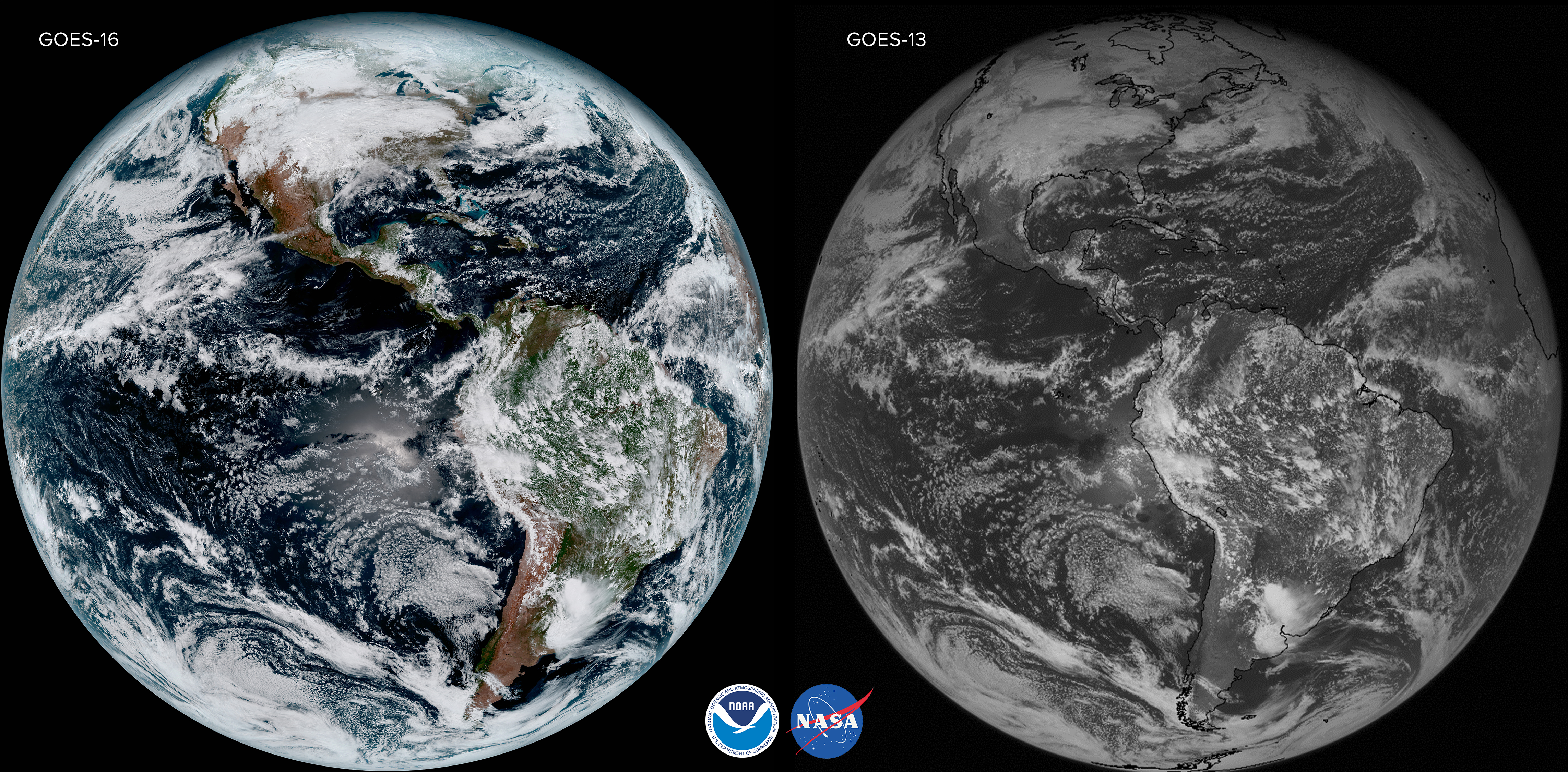
Click for a much larger version
Hey, I can nearly see my house from here in this medium resolution image of the Northeast US taken in January:
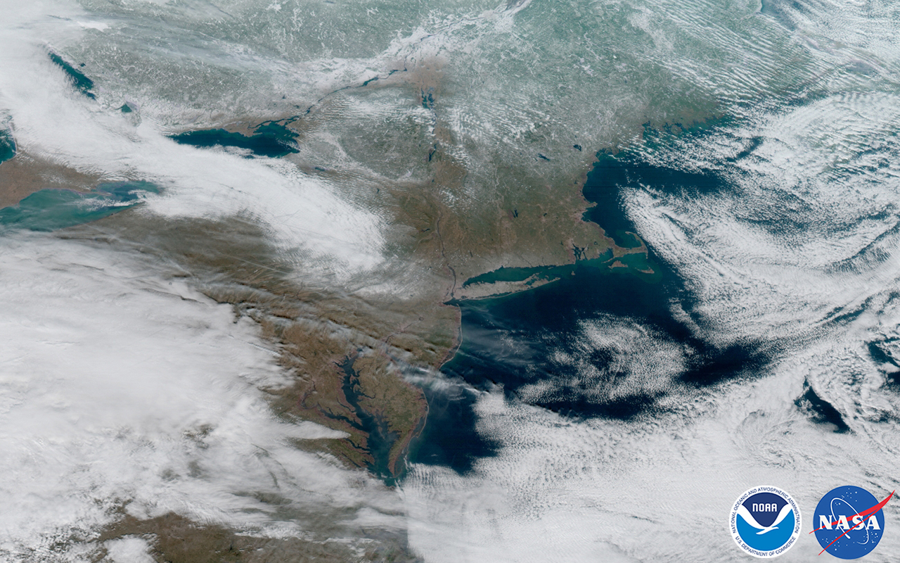
Click for a larger version
